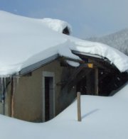
The
Jura mountains run in a southwest-northeast direction along the border between
France and Switzerland, from Geneva (Genève) to Basel (Bâle), holding at about
1300-1400 meters altitude (4350-4500 feet), and peaking in the range of 1650 meters
(5450 feet). These photos of high alpage farms in winter are mainly from the southwestern
end of that range, between the cities of Geneva and Vallorbe.
Chalet
du Mont Tendre

Chalet
du Mont Tendre, 13 March 2005, Lac de Neuchâtel behind.

The
Chalet du Mont Tendre (1615 meters altitude) lies at the top of a paved road just
600 meters northeast of Mont Tendre summit. In summer, when the road is open,
the farm doubles as a "buvette" and mountain restaurant for hikers and
daytrippers, specializing (of course) in cheese dishes.
This
is a stormy 7 April 2001, with the pylon on Mont Tendre summit in the background.

A
stormy sort of Saturday, 7 April 2001, with not much snow left on the ground.
Over the next two weeks, nearly a meter and a half fell unexpectedly, and the
mountain bikes and (for some) the bikinis went back into basement storage to rest
up some more for summer.

Viewed
7 April 2001 from the southwest, passing by on the way to Mont Tendre.

Chalet
du Mont Tendre, 7 April 2001, seen from the windswept summit pylon on Mont Tendre.

From
the upper side, looking out over the plateau, a rainy 30 March 2002.

From
the south, 16 November 2003

From
the Carte National de la Suisse, 25,000 scale: 1221, Le Sentier.
 Dwight
Peck's farm photos


