|
 Dwight
Peck's farm photos Dwight
Peck's farm photos
Farms
of the Jura in winter
The
Jura mountains run in a southwest-northeast direction along the border between
France and Switzerland, from Geneva (Genève) to Basel (Bâle), holding at about
1300-1400 meters altitude (4350-4500 feet), and peaking in the range of 1650 meters
(5450 feet). These photos of high alpage farms in winter are mainly from the southwestern
end of that range, between the cities of Geneva and Vallorbe.

Perroude
de Marchissy

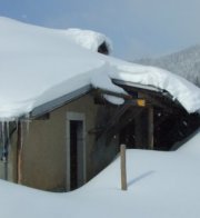
Perroude
de Marchissy, at 1429m, lies on the transjurassien hiking trail the Chemin des
Crêtes, along the Jura ridgeline between the Crêt de la Neuve to the
northeast and the farm Perroude du Vaud to the southwest. 12 December 2004


Here
in a lightly raining afternoon, 1 April 2002.
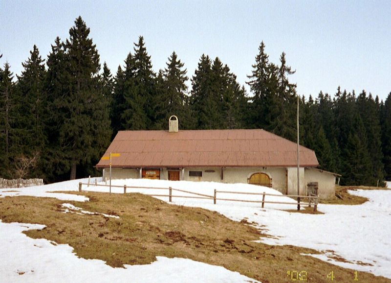
A
single-lane paved road dead-ends here from the village of Marchissy at the bottom
of the forest, 600 meters lower down the mountain.

In
the summer, when the road is open, a buvette, or light restaurant, is open here
at the weekends.

The hiking
trail signs show, from the other side, the landmarks along the path -- the red-and-yellow
diamond sign is the special trailmarker for the Chemin des Crêtes.

from SwitzerlandMobility (http://map.schweizmobil.ch/?lang=en)
 Feedback
and suggestions are welcome if positive, resented if negative, Feedback
and suggestions are welcome if positive, resented if negative,  .
All rights reserved, all wrongs avenged. Posted 10 August 2002, revised 2 July
2007, 10 January 2014. .
All rights reserved, all wrongs avenged. Posted 10 August 2002, revised 2 July
2007, 10 January 2014.
|


