|
Winter 2013-2014 Dispatches from way, way behind the lines in Switzerland You may not find this terribly rewarding unless you're included here, so this is a good time for casual and random browsers to turn back before they get too caught up in the sweep and majesty of the proceedings and can't let go. Some late January expeditions The Réfuge de la Joratte
We're aware of the general direction (southwest), but the rest is improvisation.
So far so good
The terrain makes its own decisions about our route.
We continue . . .
. . . and improvise some more.
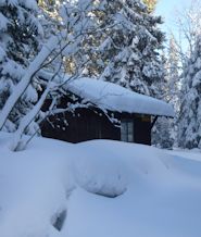
Bingo. The Réfuge de la Joratte, 1330m. We know where we are now.
The Réfuge de la Joratte, and a selfie photo in the window
Improvising again
Time-consuming, and disorientating
And mined by holes in the limestone forest floor
Finally, a recognizable forest road, with an old ski track on it. We know where we are, and will return.
Back past the Réfuge de la Joratte
An old ski track, and still older footprints
Some idiot postholed through here with no skis or snowshoes on -- poor sod. Oh. That was me.
Nearly done for the day.
A good start for Chalet Neuf, but our project needs work. The Réfuge of Pierre à Ecusson
A few days later, 24 January 2014, we're back for another go at our Chalet Neuf project.
The road up to the Col du Marchairuz
With, finally, some sunlight from time to time
We begin from the Marchairuz road at 1313m, across from the farm of Meylande Dessus.
Meylande Dessus, with Mont Tendre in the distance
Off we go. To the southwest again. Where the dark clouds are rolling in.
The cistern, where if memory serves we are to turn left
Into the forest
We're not the first along this path. In fact, we were here with Kristin and Joe not too long ago.
This time we're operating on a Plan, and it's time to leave the signposted trail, and improvise.
Off we go.
Someone, sometime ago, had the same idea.
An unreliable limestone forest floor
Like a welcoming alley through the trees
A very beautiful sunny, silent forest
With a helpful vestigial track to follow along on
Out to a recognizable road. Now comes Phase 2.
An unsignposted trail, still going southwest, with a helpful trail on it already
Memorializing the moment
The helpful track is still before us, but we're otherwise pretty lost.
Bingo. A trail sign of sorts.
Soon confirmed, back onto a balisé or signposted trail. We turn left here.
The refuge of Pierre à Ecusson at 1346m
Now what?
Another promising old track
Checkpoint
Past the Réfuge de la Joratte again
A helpful trail marker on the tree
We're joining our track from earlier today, so the rest is just plodding it home.
The cisterne
In glorious late afternoon sunlight
The final stretch
Our track back to the car
Phase 3 of our project is still to come.
|
Recent Events
|
 Dwight Peck's personal website


