|
 Dwight Peck's personal website Dwight Peck's personal website
Summer
2005
A
walk up to the Col des Essets
You
may not find this terribly rewarding unless you're included here, so this is a
good time for casual and random browsers to turn back before they get too caught
up in the sweep and majesty of the proceedings and can't let go. We've
been hanging out in this region of the world for nearly thirty years but it never
gets old.
We're
starting from the Pont de Nant, 1253m, which lies at the top of the tiny road
from Les-Plans-sur-Bex, which is in turn just uphill from Bex in the valley of
the mighty Rhône. Here's the famous alpine botanical garden, the Thomasia
(3,000 varieties), created in 1891 and by some accounts the oldest alpine garden
in the world. Marlowe Peck visited here three days before her birth.
We're
heading eastward, but to gain some height we plod up southward from the farm of
Le Richard (1535m) in the direction of the Plan Névé on the side
of the Grand Muveran.
| 
Le
Richard, 2002
|
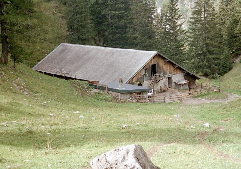
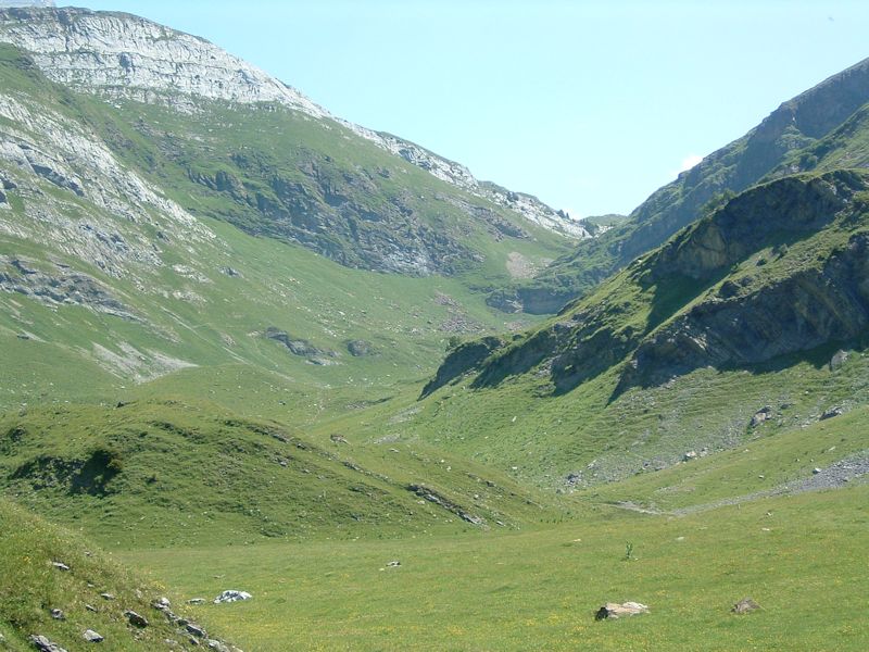
Here's
a view of the trail near Le Richard towards Plan de Névé,
before our route turns left behind that head farther back in the gulley. These
two photos were taken on a cloudier day a few years ago whilst lumbering
upward towards the Cabane de Plan Névé.
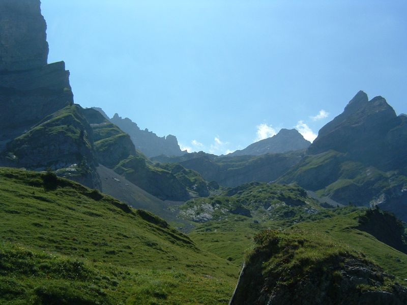
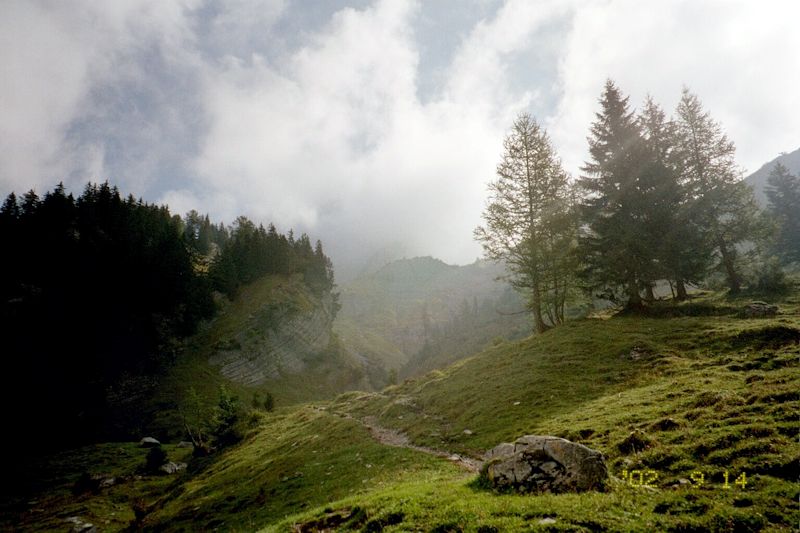
Gorgeous
colors on a brilliant, warm (in fact, VERY warm) day, 17 July 2005.
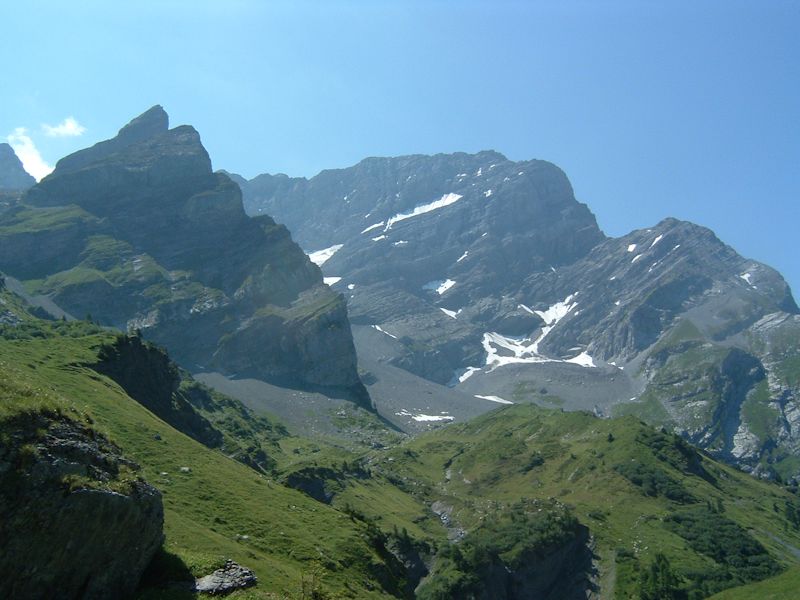
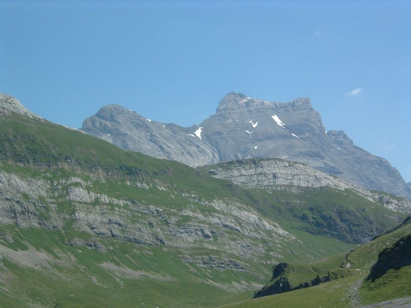
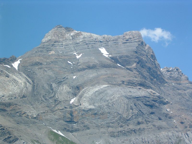
There's
the Grand Muveran, one of the four pillars of the Préalps -- the magnificent
~3,250-meter peaks in a line that guard the big Alps from the Swiss Plateau. These
are the Diablerets, the Grand Muveran, the Dents
de Morcles, and the Dents du Midi.
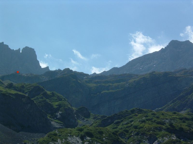
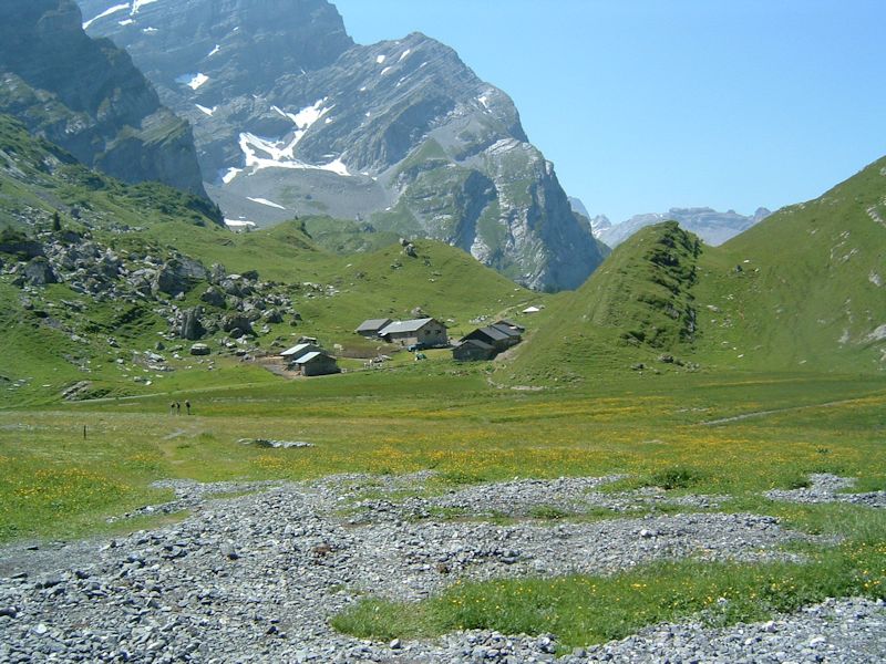
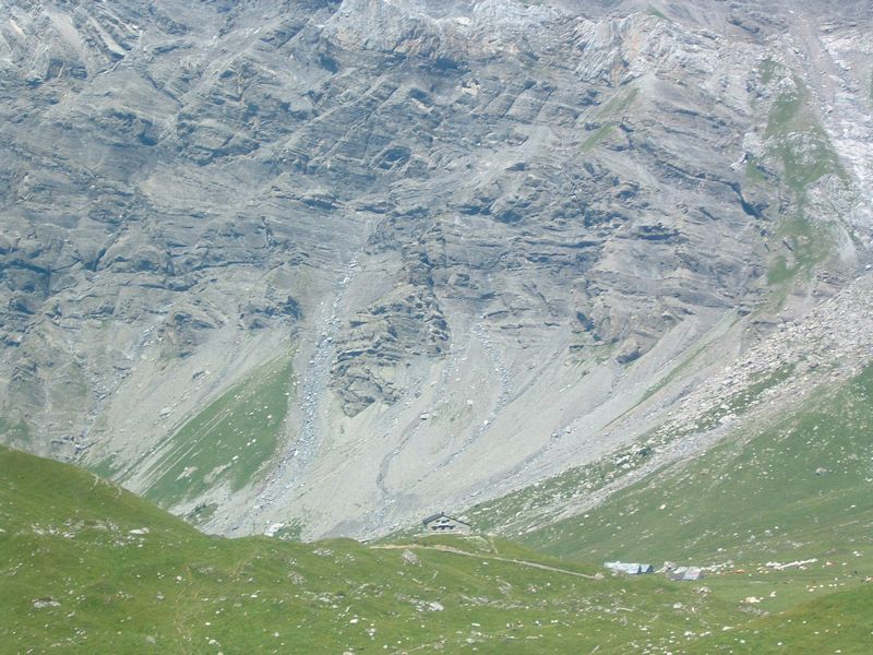
Before
we turn northeast towards the Col des Essets, here's a distant glance at the cabane
de Plan Névé (red dot). Now, at about 1700m, we turn left!
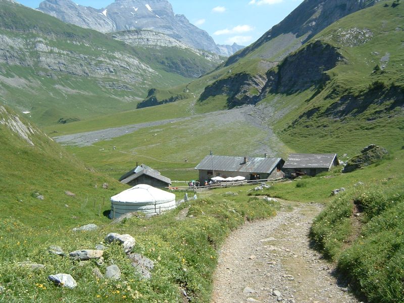
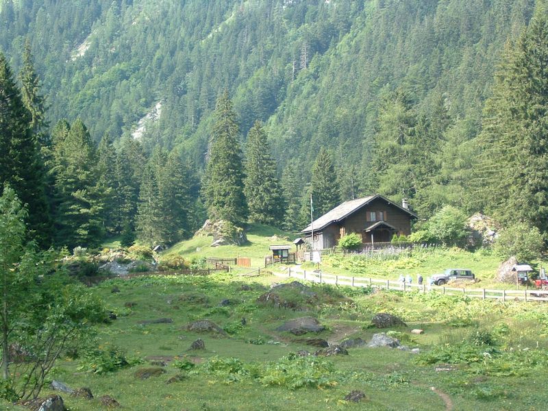
And drop
down onto the lovely mountain social thing at La Vare, at 1756m, at the front
(southwest) edge of the hanging valley overlooking Le Richard behind us. That's
a yurt in the foreground; the rideable donkeys are lounging about in front of
the rightmost building. The summit of the Diablerets is back there in the . .
. .
. . .
distance. 3209m high, with some wonderful great glaciers behind it, for the
next five or ten years. (If you want to see the grand Glacier of Tsanfleuron,
do it soon, before George Bush and his friends finish it off.)
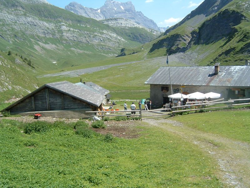
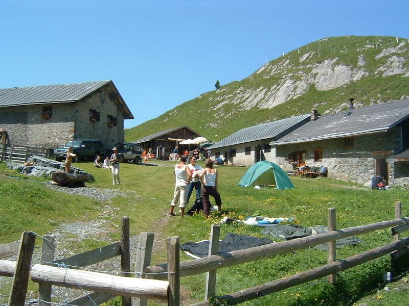
The
folks at La Vare farm have an active social life, by the looks of it; we found
sportif people relaxing all over the place, with the buvette/restaurant
. . .
. . .
and apparently a dormitory (dortoir) over on the right. The sign says the
"fromagerie" or cheese-making place, but people were dropping off their
backpacks and going back for a beer.

What's
more, everybody looked so happy!
La
Vare with the Muveran behind. Now we're headed for the Col des Essets.
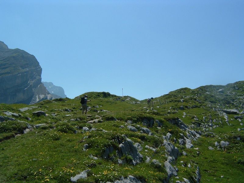
That's
the way forward, with the Col des Essets somewhere up there in the centre.
The narrator,
in his semi-youthful running days, had an annual
running route that began at Barboleusaz near Villars (1211m) up past the mountain
restaurants at Solalex (1462m) on the far side of the Argentine (left of this
photo) to the tiny hamlet of Anzeinde (1876m), past the Cabane Barraud (1956m)
and the Col des Essets at 2029m -- and then down
this lovely hanging valley towards La Vare, the Pont de Nant, then the "ladder
trail" to Plans-sur-Bex, and finally 10km down the brutally punishing road
to Bex on the Rhône (430m). A bracing 3:11:32 hour run, but with
not much leisure to look round and admire the scenery.
Dr Pirri nearing the Col des Essets
And now we're at the Col (2029m), gazing down up on the Cabane Barraud
(1956m), lower centre, and behind that, on the lower right, the hamlet of Anzeinde
(1876m), where, way back in the year 2000, Kristin and the present narrator wolfed
down the most delicious "lunch montagnard" of potatoes and cheese at
the Refuge Giacomini, one each, having walked over the Pas de Chevilles from Derborence
off to the right (east).
There's the Diablerests, looming a bit, making sure that we don't forget it's
there.

Whilst
lunching at the Col des Essets (2029m) and making small talk, we're gazing due
south up the ramp leading rightwards onto the Glacier de Paneirosse, where some
years ago the narrator and Professor Ware skied up the glacier to the Col
des Chamois (2680m) on crosscountry skis and spent several hours trying figure
out how to get down again.

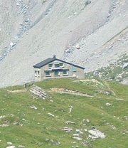
The
Cabane Barraud (1956m)
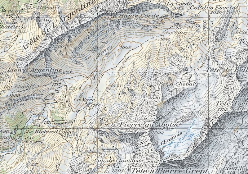
The
Col des Essets in the upper right, La Vare in the lower left, the Col des Chamois
at bottom right. From SwitzerlandMobility (http://map.schweizmobil.ch/?lang=en)
And home again.

 Feedback and suggestions are welcome if positive, resented if negative,
  .
All rights reserved, all wrongs avenged. Posted 10 September 2005, revised 7 July
2007, 28 July 2013. .
All rights reserved, all wrongs avenged. Posted 10 September 2005, revised 7 July
2007, 28 July 2013.
|