You may not find this terribly rewarding unless you're included here, so this is a good time for casual and random browsers to turn back before they get too caught up in the sweep and majesty of the proceedings and can't let go.
Two wetland walks and some more time on the lake

Setting off past a disspirited flag to trace a very old railroad right of way, 21 August 2018
A long-disused railroad right of way

There was a sawmill operating on the lake from about 1891 to about 1912, back when clear-cutting everything and moving on to the Pacific Northwest was for lumbermen a good business plan. A proper railroad was laboriously laid in over the northern Wisconsin wetlands to open up the region, and there was a smaller private railway along the lakeside to access that sawmill. Cousin Rob can find the old right of way again for us.

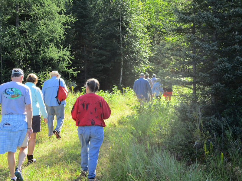
We're on the old right of way now, proceeding southward not far from the lake shore.

The rather crappy woods hereabouts are an embarrassing contrast to the old-growth forests that dominated this region before the lumber bosses showed up.

We're passing what's left of a new little cove that showed up earlier in the year, when the ice went out and the lake level rose -- with the small drop in the level from evaporation, etc., over the summer, it's been retreating.

In fact, it's nearly gone for this year; we've named it 'Ephemeral Bay'.

Looking from Ephemeral Bay across a narrower southern stretch of the lake towards the 'Tigertail' on the far side.

A cut through the little hillocks

A break in our explorations at the highway at the southern end of the lake, about 2km from the old sawmill, which is now long gone

Retracing steps past Ephemeral Bay

We resume: the old railway turned a sharp right near where the highway bridge is now and continued out to further logging areas and little lakes to the west.


The old sawmill railway passed, one way or another that's now disguised, the main north-south railroad through the region -- the old roadbed of that rail line is presently raised above the lake level through this part of its run, and, now with the rails removed, it serves as a popular 25km walking and cycling trail (and for snowmobiles in the winter).

We're being watched.
A study tour of the threatened Willow Lake area

The Willow Lake watershed, including the huge 'Willow Flowage' or reservoir and feeding into the upper Wisconsin River, is home to a great variety of healthy swamps and lakes and their wildlife. It's presently threatened by a proposal for a massive ore mine that will certainly destroy much of the near-pristine landscape, and in Gov. Scott Walker's Wisconsin, where radical Republicans have removed most protective regulations and enacted new 'business-friendly' legislation to attract mining, industrial hog farms, and what not to benefit the wealthy few, that might just happen.

We're visiting today, provided with some wetland expertise and conservation activitism, to see for ourselves what's at stake. This is a creek called '16-4' which connects the wetlands here to others in the area, a potentially useful point of law.

There's meant to be a non-binding referendum in Oneida County on 6 November 2018, and signs and banners are going up on docks and roadsides all over, but in the meantime we want to have a look at a few of the areas most threatened by the plan.

Walking in from one of the few paved roads towards some wetlands in the potential target area.


Crossing a snowmobile trail through this wonderland of recreational sports (snowmobiles and ATVs, of course, but also fishing, boating, swimming, cycling, and so on).

A group portrait

Up and over a little ridge and, if Tommy's notes are correct (he's the only one of us who's been out here before), we're coming down to our first destination wetland.

Tracy Hames, Executive Director of the Wisconsin Wetlands Association, judges this to be a very healthy and valuable wetland.

A healthy, and wet, wetland

Back up over the ridge

. . . and over to another targeted wetland. Kristin's following Tracy Hames out into the boggy expanses.

And successfully finding the way back out of it.

Having left Tracy behind, unfortunately

All this could conceivably be an open pit mine in the not too distant future. Somebody and his friends will make a pile.

Back to the road, and home
Random shots from the late summer

Melvin's got himself in a pickle.

In the end he found his own way out of it. He just jumped.

The study and bedroom porch


Another go at the canal to the next lake

Clowns one way, Jokers the other. The old sign from a year or two past has been renewed.

The canal at its widest and deepest in years

What a mess

Scouting for alien invasive weeds, frogs, turtles, and possibly little snakes


On through the culvert to the second stretch of the canal

Through the culvert under the road

Everything's trying to fall into the canal. In fact, we've brought a little saw to dispense with two trees that were blocking the way, but somebody'd beaten us to it.

At the spillway at the end of the canal

Cousin Rob, with an institutional interest in the leaky state of the ancient spillway gate, investigates once again.

And dives after another stand of the dreaded Purple Loosestrife invasive weed

We're being observed.

Back along the canal

Impending stormy weather across the main part of the lake


Rounding the point into the northern part of the lake, with Mussent Point ahead

Mussent Point, with Kristin's cottage on the right


The boathouse around the point

The little cove behind Mussent Point, twice the size of a few years ago

The tree that crashed down at about midnight not too many years ago

In the cove and wetland behind Mussent Point

The view back out to the North Bay from the cove

The Purple Loosestrife patrol never sleeps (on afternoons in good weather)

A victory over the noxious weeds. Into the black plastic trash bag.

We're being observed.

Shoreline patrol: for invasive plants and tasty mushrooms

Baby Leigh Island, like a green frigate seen end on

Another storm casualty
 Dwight Peck's personal website


