|
 Dwight Peck's personal website Dwight Peck's personal website
Lac
d'Hongrin and Leysin's backside
near Leysin, Switzerland
The
lovely village of Leysin, in the Swiss Alps, sprawls at 1250m-1450m on the flank
of a range of six small limestone peaks. These little peaks are wonderful in all
seasons.
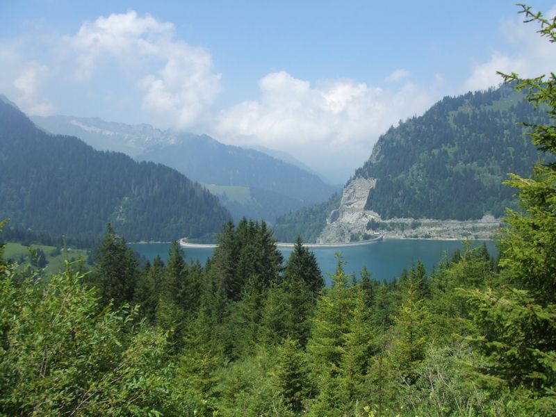
The
Lac d'Hongrin was created in 1969 out of what must have been a humongous gorge.
Beyond the double-arch dam seen here, the valley of the Hongrin creek leads down
to the town of Allières and out through an even more vicious gorge to Montbovon,
and eventually to Gruyères and the North Sea.
The
double-arch dam is apparently uncommon, but there's a monstrous rock buttress
right between them so it must have made sense to anchor the thing somewhere.
When
they dammed up the Hongrin in 1969, understandably a lake resulted, now 2.7 km
long, and we're told that it holds 53 million cubic meters of water, though historically
I've often seen it with a much lower water-level than in this photo (July 2006).

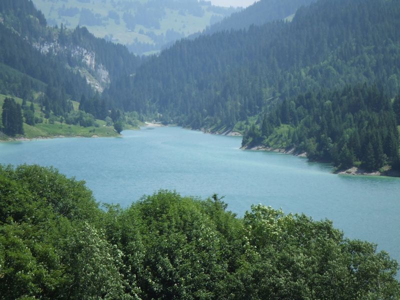
This
view is looking towards La Lecherette, the tiny farming-skiing village along the
Col des Mosses road between Aigle and Château d'Oex. The lake level, in
its proudest moments, is about 1255m asl. As of July 2006, the restaurant in La
Lecherette can make a dynamite ham sandwich to go.
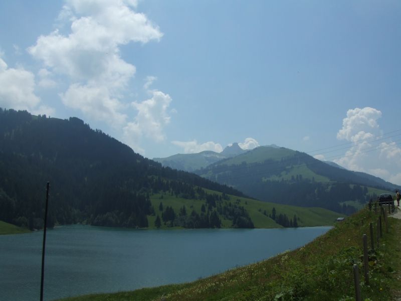
In
the other direction, that's the mighty Tour de Famelon on the horizon, one of
the Leysin Tours, and the village of Leysin is 6 or 7 kilometres down the far
side of that.
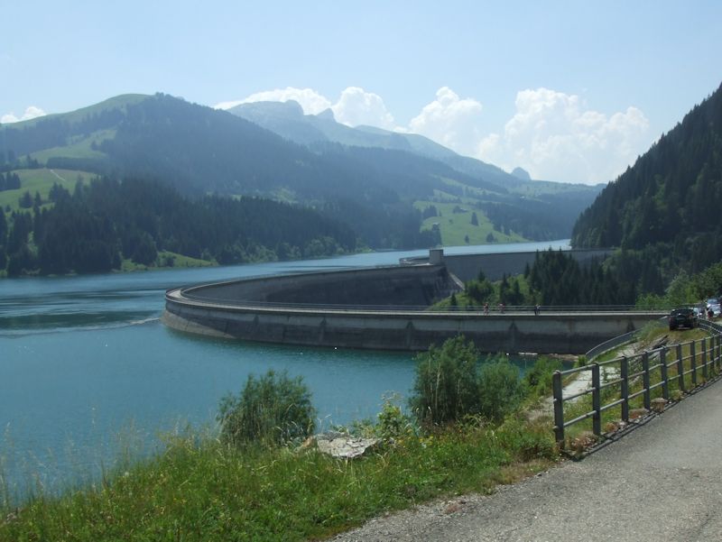
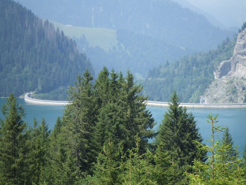
That's
the double-arch dam, or "barrage" in French, with the Tour de Mayen
way up there on the horizon. Water from the lake is dumped down a pipeline to
Veytaux (near Montreux) on the Lake of Geneva (Lac Léman) to produce
electricity. I've heard that there is
a clever scheme at work, whereby the water is let down the pipe in the daytimes
to generate electricity at peak prices, and then pumped up the pipe to the lake
again overnight when the electricity costs of pumping it up are priced at the
nighttime rates.
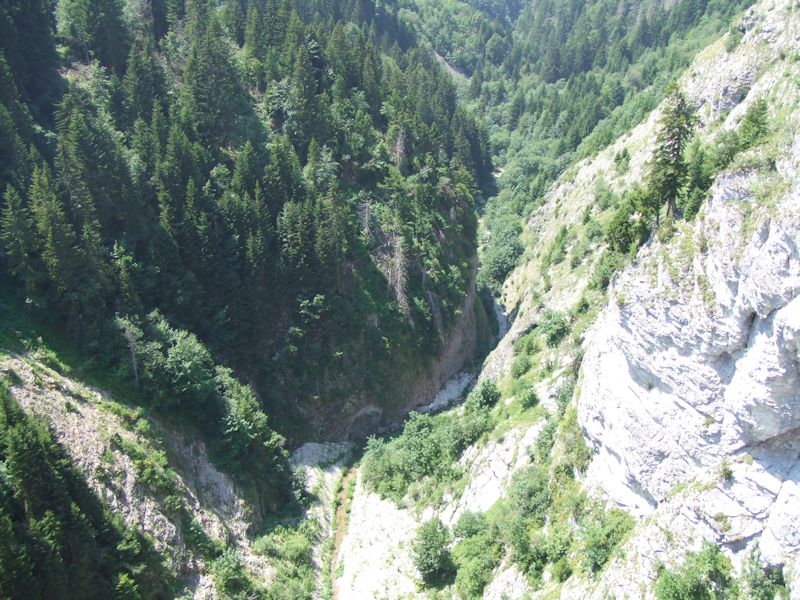
That's
the original gorge of the Hongrin creek, some 125m lower than we are now.
Alongside
the barrage d'Hongrin, the cliffside, and the original tunnel hewn out of the
rock leading down the valley towards Allières and
Montbovon. The aging narrator formerly had a running route from Leysin over the
Pierre du Moëllé down to an arm of the lake, across the dam, through
that tunnel and down to Allières, up to the Col de Jaman, past Les Avants,
and down the Gorge du Chauderon to Montreux, in approximately four hours (and
32 seconds). Another route came over the dam to Allières and out to Gruyères. The valley below the dam is very beautiful but
closed to automobiles.

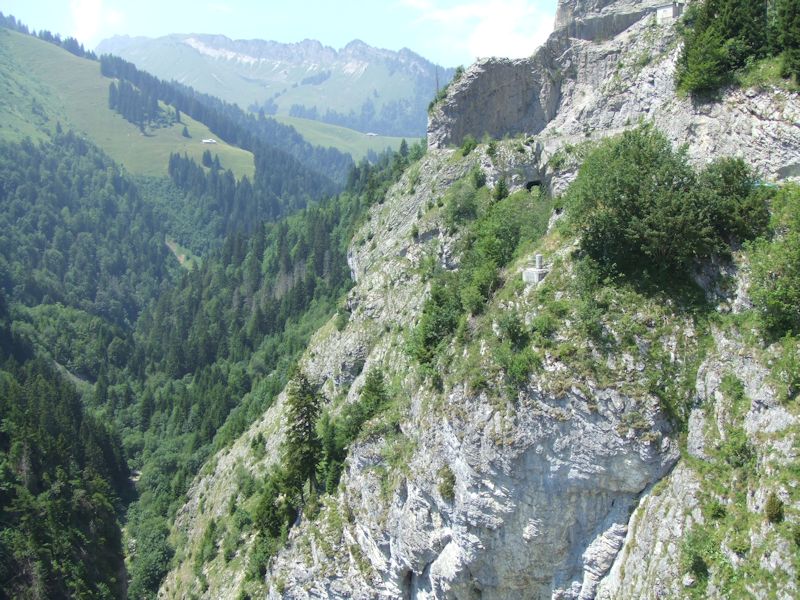
The
tunnel down the valley towards Allières (1979)

The
Leysin Tours seen from the valley of Ayerne, on the shores of the Lac d'Hongrin.
The 12km valley on the far side of the Leysin Tours to the north is one of the
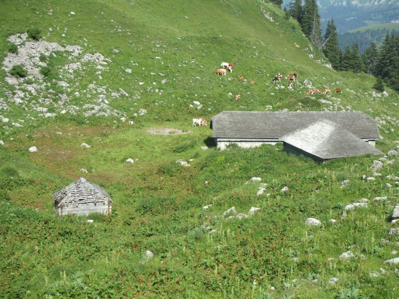
largest Swiss "places d'armes", or military training grounds. This very
spot witnesses mortar practice and tank maneuvres frequently during the year,
and if you want to hike, bike, or ski through here you have to pick your days.

That
cliffline, to the left of the Tour de Mayen, is the imposing backside of Sur les
Truex above Leysin.

And
that's the Tour de Famelon, with a lot of broken ground "behind it"
("in front" of it from this side) that served the narrator well for
snowcaving spots back in the old days.
To
speak the truth for once, we came here on 16 July 2006 to make a hike from here
over to the Rochers de Naye, but scenic beauty and general laziness intervened,
so we've got lots of time to take photographs. We'll just walk on up through the
insects to the Pertuis d'Aveneyre behind us and call it a day well-spent.

As
we're hiking up a bit now, that's the ridge of Mont d'Or, with the Mont d'Or summit
on the right and the Gros Van on the left. The village of Col des Mosses is over
on the far side of that.

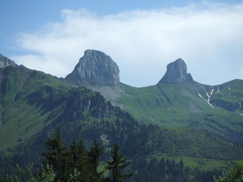
The
Leysin Tours from the north: Mayen (2326m) on the left, Aï (2331m) on the
right.

From
left, Sur les Truex, Tour de Mayen, Tour d'Aï
Les
Cases (1752m)

Kristin
on the Pertuis d'Aveneyre (1846m) overlooking Lake Geneva.


The Leysin range, from left, Tour de Famelon (2137m), Sur les Truex
(2194m), Tour de Mayen (2326m), Tour d'Aï (2331m). Only Berneuse (with the
revolving restaurant) and La Riondaz are missing off to the right.

The
Lac d'Hongrin snowed over, early 1980s.
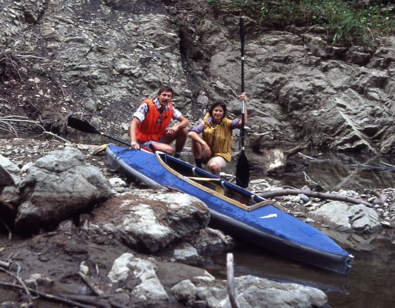
A
kayak in Lac d'Hongrin, 1983

More recent photos of the Hongrin, 2017


Index
of Leysin local mountain photos
 Feedback
and suggestions are welcome if positive, resented if negative, Feedback
and suggestions are welcome if positive, resented if negative,  .
All rights reserved, all wrongs avenged. Posted 26 August 2006, revised 17 January
2008, 29 August 2014. .
All rights reserved, all wrongs avenged. Posted 26 August 2006, revised 17 January
2008, 29 August 2014.
|