|
 Dwight Peck's personal website Dwight Peck's personal website
Views of Morat and Le Landeron
30 December 2013
A pleasant drive on a sunny day up to the Lac de Neuchâtel, Switzerland, to revisit medieval villages, etc.
You may not find this terribly rewarding unless you're included here, so this is a good time for casual and random browsers to turn back before they get too caught up in the sweep and majesty of the proceedings and can't let go.
Morat / Murten

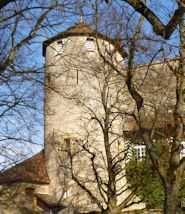
The Morat museum, just outside the southwest end of town. The village is offically named Murten, the German form (76% of the population of ca.6,000 speak German), but as it's on the Swiss linguistic frontier (the "Rösti Curtain"), it's also referred to by its French name: Morat (pron. 'more-ah').

There are meso- and neolithic lakedweller remains here, as throughout the Three Lakes district, but the settlement is first attested as a 'lakeside fortress' in AD 515.

The town itself was built in the mid-12th century by Duke Berchtold IV of the Swabian Zähringen dynasty of southwestern present-day Germany, but in the mid-13th century it passed under the protection of the Counts of Savoie based on the southern side of Lake Geneva (Lac Léman); it was tugged back and forth between the Habsburg Germans and Savoyard French for the next century.

That's the imposing castle, built by the Savoyard counts, I believe, as we've entered the town and begun our serious sightseeing. In 1476, the Duke of Burgundy, the wildly ambitious Charles the Bold, invaded the region and besieged Morat -- the town held out for two weeks and was relieved by an army from Berne and other Swiss cantons. The Swiss victory was astonishing; it was one of the most important battles of the age and put paid to Burgundian expansionism. (The volunteer armies of the Swiss cantons in the 14th and 15th centuries were the most highly respected and sought-after mercenary troops in nearly all the armies of Europe at the time.)

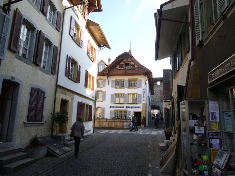
There are two main streets through the village, and this is the Rathausgasse, "City Hall Street" (the other, just next door, is the Hauptgasse or "Main Street"). For the Morat-Fribourg marathon every year (actually a half-marathon, to commemorate the bringing of the victory news to Fribourg in 1476), they line up the age and gender groups alternately between the two streets and release them out into the countryside at timed intervals. For a couple of years, I was assembled in the Rathausgasse.

All the runners dress up in huge plastic garbage bags to keep warm until the starting gun, and then shuck them off into the street at the cry of "Get Set" (or German equivalent). From the starting gun, I waded through waist-high black garbage bags for four minutes before passing the starting line at the castle gate.

Part of the port, looking out over the Lac de Morat or Murten See, and Mont Vully on the far side, with its Romain remains. We're at the city wall along the northwest side of town, overlooking the lakeside.

Kristin and the Light at the End of the Tunnel -- a sort of traboule under the buildings and city walls.

A cross-street to the centre of town, appropriately called the Kreuzgasse.

Kristin's just about where I was standing shivering, clad in a black garbage bag, when the starting gun went off, back in the olden days.

A view back at the Castle down the length of the Rathausgasse.

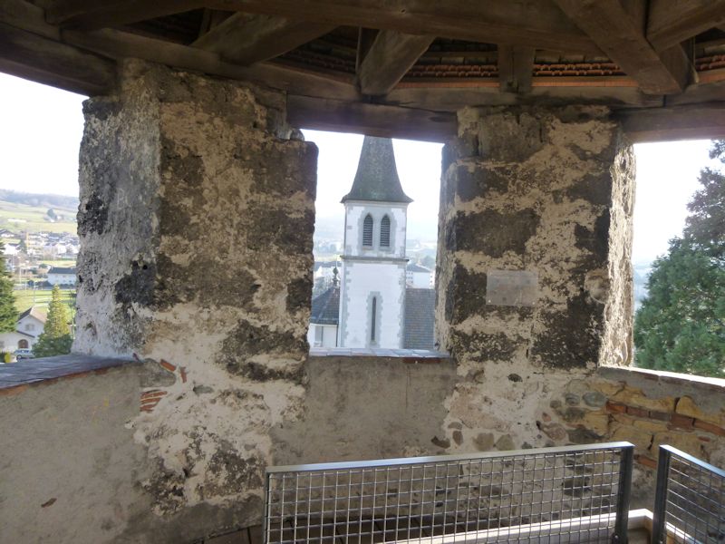
A village church, at the junction of French Church Street (Französische Kirchgasse)

Simple, but clean

A view of more of the pleasure-boat port and the far end of the lake, with its 19th century canal over to the Lac de Neuchâtel. We used to hang out in the camping ground near here with Lisa back in the day, when the kids would amuse themselves in the lake and I'd take a run over Mont Vully and around the lake in the afternoon, and here's a photo of young Marlowe in her float-boat in 1994.

We're on the Französische Kirchgasse at the Berntor, the tower and city gate at the northeast end of the centre village, whence the old road to Berne commences. Facing us is the Deutsche Kirchgasse (German Church Street). And a pizzeria.

The Berntor city gate

The Hauptgasse at the northeast end of the centre town

It's time for a pizza.

The Hauptgasse again

Street scenes


The Kreuzgasse side street towards the lake
And the Kreuzgasse the other way, towards the city wall ('Ringmauer'), for an edifying 'wall walk'

The German Church and the city wall looking northeastward

Rooftops, and the western end of the Murtensee beyond

Looking north towards Mont Vully and the Canal de la Broye

The Castle

The Catholic church of St-Maurice de Morat outside the walls

The Schaalgasse closing the circle back to the castle, from the walls

Outside the walls

The whole length of the walls along the southern and eastern side of the old town

Another view

The tiny Speichergässlein under the walls

Schaalgasse, along the inside of the city wall

The Hauptgasse and Berntor again, from the far end

The Murtenhof on the Rathausgasse

The inside of the Schloss Murten, or Castle of Morat

Administrative offices in the courtyard


The southwestern end of the old town, and the Schloss

Next, a quick visit to a nearby Ramsar Wetland of International Importance

The "Fanel et Chablais de Cudrefin", Switzerland's first Ramsar Site, designated on 16 January 1976, incorporating what's left of the huge marshes along the Lac de Neuchâtel, largely engineered into their modern configuration in the 19th century.

The heart of the Ramsar Site, the auberge and farm of La Sauge, now operated by the Swiss Association for the Protection of Birds (ASPO) and dedicated to researching and demonstrating advanced wetland management practices. Ramsar Secretariat staff got the full tour here a few years ago.

La Sauge is on the far side of the Canal de la Broye (or Canal de la Sauge), and we're on this side, walking out to the bird observation hides. The 9 km canal was built in the 1870s to regularize the river Broye and equilibrate the lakes of Morat and Neuchâtel.
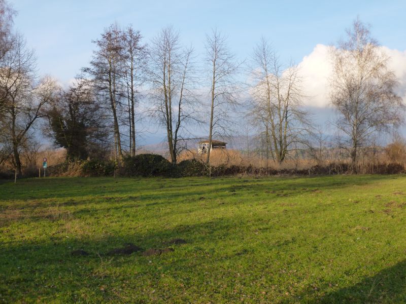
An observation hide

From the hide, a view of artificial islands, and the far side of the lake just east of the city of Neuchâtel.

Birds. The end of December may not be the best time for viewing.

That was fun.
Le Landeron

Just to the northeast of Lac Neuchâtel, near the southwestern end of the Bielersee or Lac de Bienne, the medieval village of Le Landeron sits in the middle of the fields, near the Thielle canal joining the two big lakes. This is the northern gate of the town.

The village school, with the highway running through it. There were people here from the earliest times, but the fortified villages dates from the early 14th century, built by the Counts of Neuchâtel to cover the eastern approaches to their domain.

The main street, in fact the only street, of the old town

A sort of noble knight guarding the city gate

A view of nearly the entire old town

The northern gate again, and its knight

Marie d'Orléans-Longueville, the Duchess of Nemours, fought to retain legal ownership of the town in the 17th century, and the villagers were steadfastly loyal to her in her legal battles.


Street scenes


The southern gate has its own knight . . .

. . . a very unhappy knight

The southern gate of Le Landeron
 Feedback
and suggestions are welcome if positive, resented if negative, Feedback
and suggestions are welcome if positive, resented if negative,  .
All rights reserved, all wrongs avenged. Posted 23 February 2014. .
All rights reserved, all wrongs avenged. Posted 23 February 2014.
|