|
 Dwight Peck's personal website Dwight Peck's personal website
Winter
2005-2006
Short
breaks from poring over the newspapers as the Bushies implode
You
may not find this terribly rewarding unless you're included here, so this is a
good time for casual and random browsers to turn back before they get too caught
up in the sweep and majesty of the proceedings and can't let go.
A round-up
of new farm pix, 4 and 5 February 2006

We're
here (the royal "we") at the Bugnonet-Chaumette winter trailhead (971m)
above our hometown of Bassins, and our scheme for today is to update our
Farms of the Jura photos with some new ones from the digital camera era.
Presently we're bound for Le Bugnonet over there on the right. (We've
no idea who those young folks are up ahead -- let's let them get ahead a bit.)
The
Bassins "Route de Montagne" has a barrier across it at this point, but
we've been very badly served by some "skimobiles" ("motoneiges"
in French) that, as you see, have got round it and have effectively trashed the
roadway right to the top of the mountain. But we'll be bushwhacking straight
up the forest anyway, and getting lost in the Bois au Ministre to get some late afternoon
shots of Le Crot.

There's
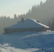
Le Bugnonet (995m). It would sure be nice if the sun would peek out about now.

But
no sun today, not here anyway -- the top of the fog is at about 1100m.


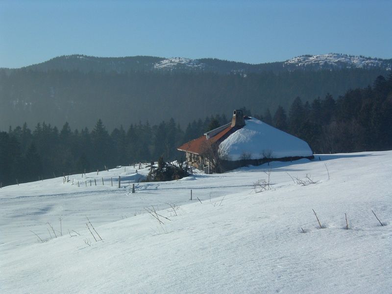
Here we are. We've dragged our way straight up through the lovely hard snow and finally
found the sun at Le Crot.

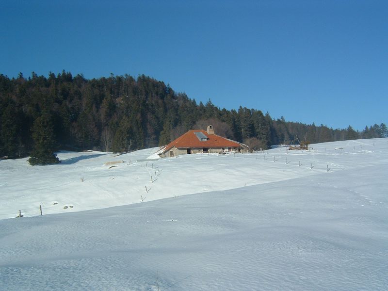
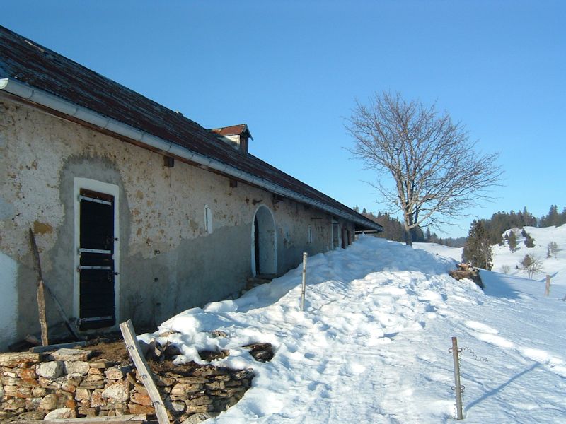
This
is the farm of Le Crot (1225m) at about 4 p.m., with Mont Sâla (1511m) looming
behind. Maybe not looming, maybe just settled comfortably in up there.
We
trot around the east side of Le Crot with a nice view on the horizon: (from
left) Mont Pelé (1532m), forested and frequently unfindable amongst the
trees; an unnamed middle one (1515m), and Mont Sâla (1511m) on the right.
They're about 4 kilometres away from us now, up on the Jura ridgeline.

We circumambulate
the building (we're standing on a pile of forestry logs for this shot from the
north), squeezing off lots of digital shots to choose from later, changing the batteries
from time to time.
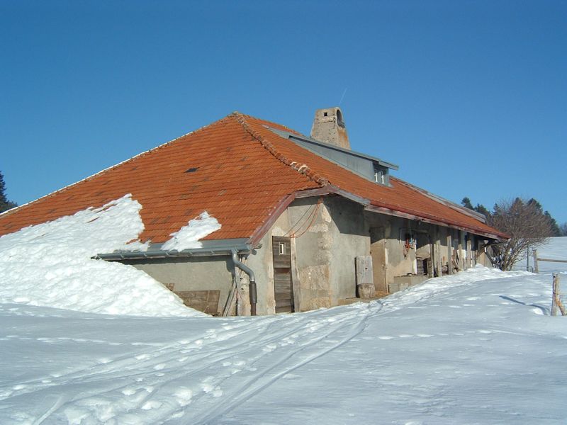
And
the front, facing out over Lake Geneva to the south
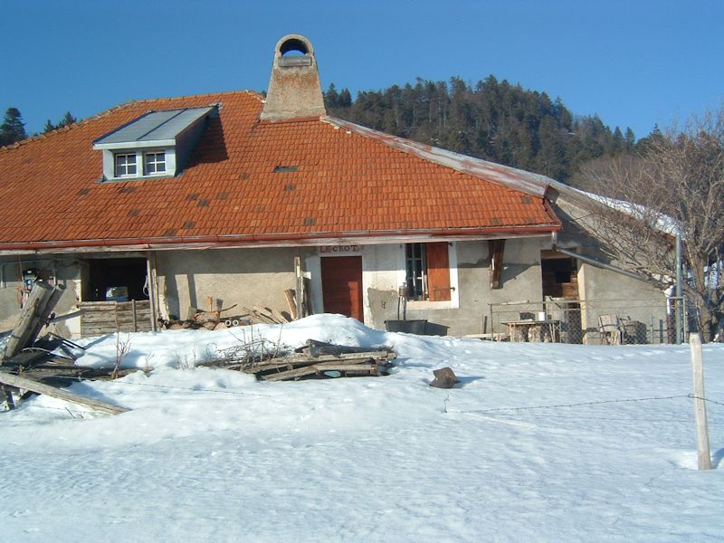
Whenever
we can, we also catch a picture with the name of the farm in it: in this case,
Le Crot.

It's
well past 4 p.m. and the temperature is plummeting, so we'll have to trot along.
We're
leaving Le Crot to cross the Route de Montagne to pick up the Chemin des Crêtes
international hiking trail lower down and find Les Frasses.

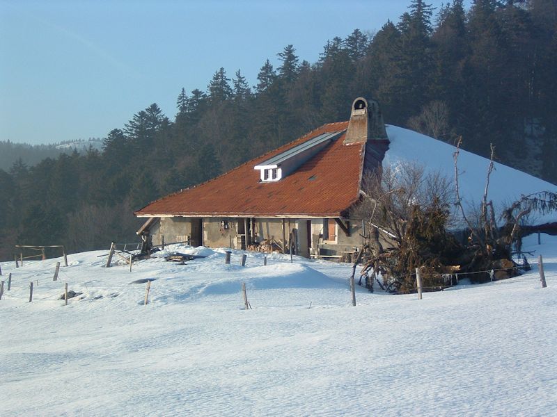
And
here's the farm of Les Frasses (1151m), along the Chemin des Crêtes.

We're
actually racing along here because the sun is just going into the tank and we
may not make it to the building in time for any good shots.
Almost out of breath
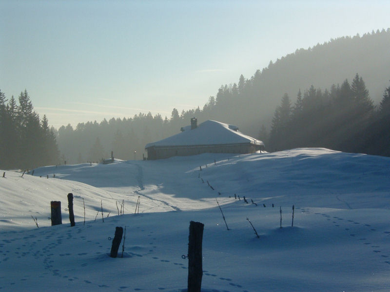
Just
in time -- that's the southeast front of Les Frasses, with the Chemin des Crêtes
trail sign on the beam. Now it's nearly 5 p.m., and we haven't a moment to linger.

A
trail sign at dusk -- La Dunanche is out on the flat, Les Frasses is back the
way we've come. But we're in a hurry now.


There
are those skimobile tracks again. People from the city, probably, who typically
love their "vroom-vroom". But now we'll bushwhack down through the forest
as speedily as may be, as we "feel how swift how secretly / The shadow of
the night comes on", mainly really really cold.
"To
feel the always coming on
The always rising of the night."
And the
waterbottle's frozen up again.
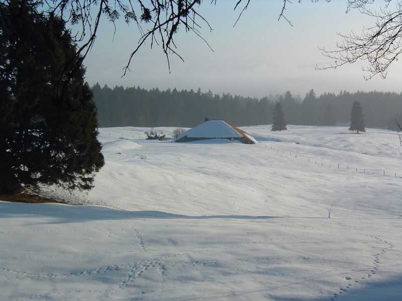
The next day

We're
back the next day, 5 February 2006, for more updated farm photos, but it's not a welcoming sort of day. That's Le Bugnonet again.

Out of the fog again. We were heading for Perroude du Vaud, but we spent so long thrashing about in the forest
getting up to this point, 1370m at 4 p.m., that we'd better turn a sharp left
and follow the Chemin des Crêtes SSW towards Le Planet.
Le
Planet sits at 1364m on a kind of promontory overlooking Lake Geneva -- there
it is dead centre. There, in the centre . . .

There!

A
mere 20 minutes later we're huffing and puffing up to the old barn door.


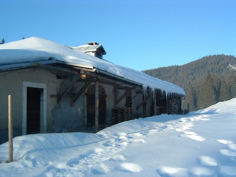
Le
Planet, late afternoon, 5 February 2006
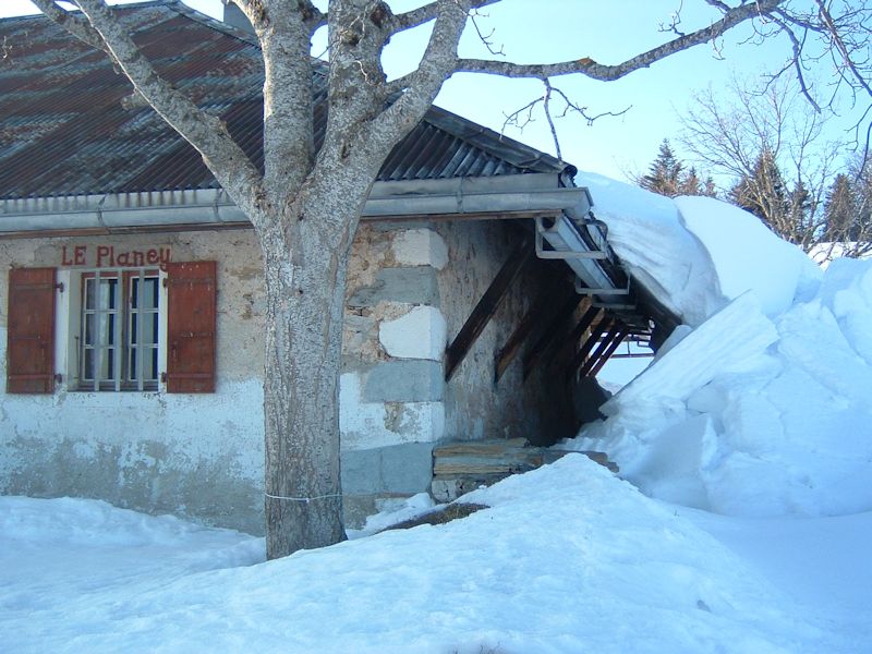
Spelt
"Le Planey" here, mind you.

But "Le
Planet" here. The yellow trail signs with the red marker are distinctive
of the Chemin des Crêtes hiking trail, which winds along through the Swiss
Jura mountains from Germany to France.

Down towards the fog again (La Dôle veiled on the right horizon)
Down
we come from Le Planet to Le Crot again, pretty much unchanged since yesterday,
in a race with the sun at 5 p.m.
Goodbye,
Le Crot. "To feel the always coming on / The always rising of the night."
And the water flask has frozen up again.

from SwitzerlandMobility (http://map.schweizmobil.ch/?lang=en)

 Feedback
and suggestions are welcome if positive, resented if negative, Feedback
and suggestions are welcome if positive, resented if negative,  .
All rights reserved, all wrongs avenged. Posted 5 February 2006, revised 7 January 2011, 18 August 2014. .
All rights reserved, all wrongs avenged. Posted 5 February 2006, revised 7 January 2011, 18 August 2014.
|