|
 Dwight
Peck's farm photos Dwight
Peck's farm photos
Farms
of the Jura in winter
The
Jura mountains run in a southwest-northeast direction along the border between
France and Switzerland, from Geneva (Genève) to Basel (Bâle), holding at about
1300-1400 meters altitude (4350-4500 feet), and peaking in the range of 1650 meters
(5450 feet). These photos of high alpage farms in winter are mainly from the southwestern
end of that range, between the cities of Geneva and Vallorbe.

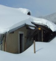
Chalet
de la Dôle

The Chalet
de la Dôle squats at about 1440 meters in a bowl just east of the front
side of the Dôle summit. Just next to it is the bottom end of the utility
lift which supplies the Geneva airport radar installations at the top.

Here's
the farm on 24 April 2004, with La Dôle up on the left, the Pointe de Poêle
Chaud on the right, and Col de la Porte on the horizon in the middle.

There
it is with the Pointe de Poêle Chaud in the background.

There's
the chalet from the little hill above it, from the south, seen by hikers photographing
chamois cavorting in the area.

On this occasion, 24 April 2004, we've come up to see the chamois, and saw a lot of them.

From
the Col de Porte, 2 April 2006

La
Dôle summit from near the Chalet.

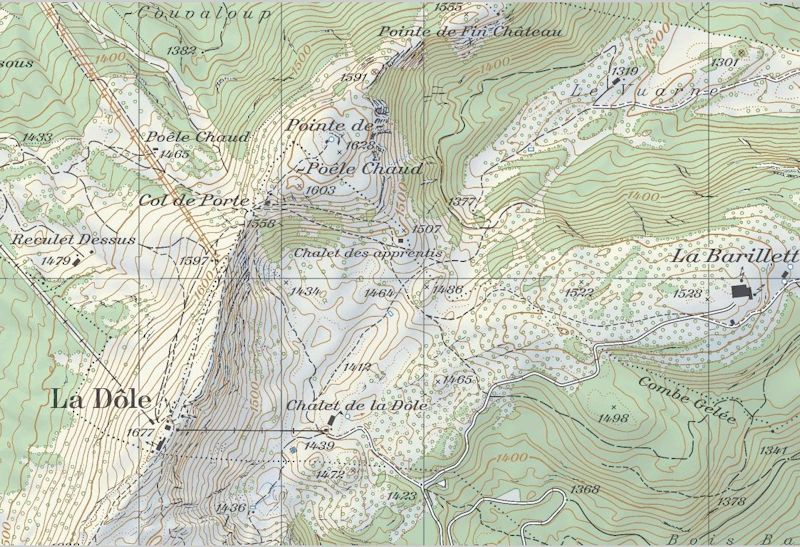
from SwitzerlandMobility (http://map.schweizmobil.ch/?lang=en)
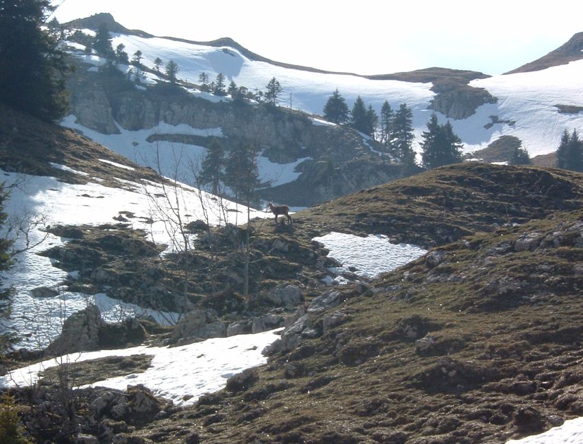
Chamois
near the Chalet de la Dôle, 24 April 2004.

Seen from the col between La Barillette and the Col de Porte, 18 January 2013

The same
 Feedback
and suggestions are welcome if positive, resented if negative, Feedback
and suggestions are welcome if positive, resented if negative,  .
All rights reserved, all wrongs avenged. Posted 2 May 2004, revised 22 November 2013, 19 January 2020. .
All rights reserved, all wrongs avenged. Posted 2 May 2004, revised 22 November 2013, 19 January 2020.
|


