|
 Dwight Peck's personal website Dwight Peck's personal website
A visit to the USA, summer 2014
More annual lakeside fun in the Northwoods
You may not find this terribly rewarding unless you're included here, so this is a good time for casual and random browsers to turn back before they get too caught up in the sweep and majesty of the proceedings and can't let go.
The Penokee Hills and the Bad River Slough

The Penokee Hills in Wisconsin's Northwoods, at the head of the watershed draining northward into Lake Superior, are under attack by a predatory open-pit mining company called Gogebic Taconite (GTac), aided and abetted by the far-right-fringe state government of Gov. Scott Walker.
We're here with Wisconsin wetland experts to learn more about what's at stake. That's Liz and our guide Bill Heart squishing towards a panoramic lookout for an introductory overview, 17 July 2014.

Stragglers

Squish, squish

Rob surveys the world from his mountain crag. The material sought is a very dirty and low-grade kind of iron called 'taconite', but the experience of the company that created GTac for the purpose is in coal mining. Which is different.

Bill Heart, of the Penokee Hills Education Project and the Wisconsin representative of the national organization Trout Unlimited; Tracy Hames, executive director of the Wisconsin Wetlands Association; and Liz.

Kristin and Joellen emerge from the wilderness.

Ahead of us to the southwest, Upson Lake, west of Hurley and Ironwood, Wisconsin, and the Penokee Hills ridgeline, the 22-mile long proposed site for the 1,000-foot deep strip mine, at the head of the watershed.

In terms of environmental risk, there are really two areas of intense concern: one is the almost certain damage to the hills themselves, with toxic tailings filling the valleys and poisoning the water and air, and the other is the consequent downstream damage, outside the mining site but within the protected wetlands of the reservation of the Bad River Band of the Lake Superior Chippewa.

It's time for explanations of the hydrology of the watershed.

The Kakagon and Bad Rivers, and their quadrillion tributary streams, rise in the Penokee Hills and flow directly into the Bad River reservation and its traditional wild rice harvesting within the coastal Kakagon and Bad River Sloughs . . .

. . . here.

Group photo: Liz, Kristin, Joellen, and Rob, and Bill Heart gazing on beneficently.

Back out to the forestry road, and on to our next checkpoint

Straggler

Waterfalls and streams by the roadside. This is not the place to unravel the long sordid tale of corporate deceit and government graft -- there is already a vast literature available (google 'penokee hills mine') -- but it would be a shame to pass up the lovely story of the mining company's having hired private SWAT teams with intimidating riot gear and assault weapons to keep protestors and independent scientists away from the area, only to discover that the "security company" was not licensed to operate in Wisconsin.

Yield!
Not to mention that the president of GTAC, who has promised environmentally fail-safe new technology for the Penokee mines, is presently wanted by Spanish law enforcement for the same bait-and-switch act at the Cobre Las Cruces mine near Sevilla. Or that the majority owner of GTAC's corporate parent firm is perhaps best known for entertaining Tiger Woods' ex-wife on his 164-foot yacht.

Up on the ridge at the top of the watershed, we're visiting a huge beaver dam and its lake (all of which will be gone if the company can evade enough licensing laws or manage to get some more of them changed).

Kristin watching out for the elusive Castor canadensis

Trekking to the beaver dam

On the dam itself: Bill Heart, Kristin, and Tracy Hames

Looking in one direction along the beavers' dam . . .

. . . and in the other direction as well.

The engineering command centre is out there in that beaver 'lodge' . . .

. . . there.

Evidently when one of their lakes begins to silt up, they just up sticks (not literally) and move a ways downstream to build a new dam. And so on.

Yuck.

Ready for a group photo . . .

A quiet smile will suffice.

Over to Caroline Lake to wash the mud off
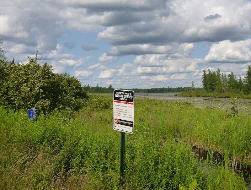
'Prevent the spread of Invasive Species. It's the law!'

Our guides have shown us round to a diversity of different ecological features in the Penokees that would be impacted or destroyed by the strip-mining operations, and now we've got one more place to see before the end of the day.

We're traversing the ferns to follow a creek up to a small ravine

Bill taking the water temperature in a little side creek


A small ravine

(Photo by Rob Hagge)

Whether the iron here is low-grade or high-grade (it's low-grade), it makes the compass go crazy!

Our excursions at an end for today, we're retiring to the Hotel Chequamegon on the Lake Superior waterfront in Ashland, Wisconsin.

With good views from the room at a marina and northwest across the Chequamegon Bay

And an excellent and convivial dinner. After a day spent viewing the upper watershed, tomorrow we'll be learning more about the likely downstream effects of the proposed mining on the ecology and the way of life of the Bad River Band in their reservation.
The Kakagon and Bad River Sloughs

A fairly early start in Ashland, known for its painted buildings all over town. 18 July 2014.

We convene at the Bad River Band's fish hatchery on the Kakagon River near Odanah, Wisconsin. The vast estuaries of the Kakagon and Bad Rivers, flowing down from the Penokee Hills watershed, are part of the reservation of the Bad River Band of the Lake Superior Chippewa tribe.

Our guide is Mike Wiggins, Jr., the tribal chairman of the Bad River Band and a sophisticated and tireless advocate for the band's environmental, social, and cultural well-being.

Our transport. Through the efforts of the Bad River Band and the Wisconsin Wetlands Association, the Kakagon and Bad River Sloughs were designated by the United States government for the Ramsar List of Wetlands of International Importance, added to the List in 2012 as Ramsar Site no. 2001. Here is the site description I prepared at the time for the Ramsar database, based on the technical information provided with the designation documents:
Kakagon and Bad River Sloughs. 02/02/12; Wisconsin; 4,355 ha; 46°39'N 090°41'W. National Natural Landmark. A largely undeveloped wetland complex composed of sloughs, bogs, and coastal lagoons that harbor the largest natural wild rice bed on the Great Lakes. The area is under tribal management that is protected as a Conservation Area by an Integrated Resource Management Plan under the jurisdiction of the Bad River Band of the Lake Superior Tribe of Chippewa. The endangered Gray Wolf (Canis lupus) and threatened Canada Lynx (Lynx Canadensis) are two rare and elusive species known to inhabit the site. It provides necessary and rare feeding, resting, and nesting habitat for both migrating and local populations of birds, and one of the two remaining sites for the endangered Piping Plover (Charadirius melodus) is located immediately to the north at Long Island. The site also protects wild rice beds that are becoming increasingly fragmented on Lake Superior - as the only remaining extensive coastal wild rice bed in the Great Lakes region, it is critical to ensuring the genetic diversity of Lake Superior wild rice. Tribal members frequent the area primarily for subsistence trapping, hunting, fishing, and to retain historic harvesting techniques; access to the area is strictly limited to Bad River tribal members and Bad River Natural Resources staff. The largest ecological threat to the site is from invasive species and from controversial potential mining activity in the Penokee-Gogebic Range upriver. In the surrounding areas water quality also could potentially be affected by municipal wastewater, failing household septic systems, and agricultural and logging practices within the watershed. Ramsar Site no. 2001. Most recent RIS information: 2012.

Mike Wiggins, Jr. (Photo by Rob)

Liz in the centre, with the Wisconsin Wetlands Association's director Tracy Hames on the right, and Outreach Programs Director Katie Beilfuss on the left.

We first met Katie in Bucharest, Romania, in July 2012, where she represented the Wisconsin Wetlands Association in receiving the triennial Ramsar Wetland Conservation Award in the Education category. (And PDF brochure about the 2012 Awards.)

The Wisconsin Wetlands Association receiving the Ramsar Award for Education from Mr Yoo Yeon-Chul of the Republic of Korea, Chair of the Ramsar Standing Committee, July 2012 |

Arrowhead plants along the borders of the Kakagon River -- there was much discussion of which kind of arrowhead plants these are, which I cannot summarize adequately.

Various branches of the Kakagon River, around Little and Big Islands, and with tributaries like the Beartrap Creek, as we progress towards the estuary on the Chequamegon Bay of Lake Superior. The mouth of the Bad River is farther to the east, and there is a vast swamp or slough (pronounced "slew" in the US) in between.

The Treaty of La Pointe (1854) between the United States and the Bad River Band establishing their reservation (like US treaties with other American Indian groups) is a solemn treaty between sovereign nations, and as such it takes legal precedence, according to the US Constitution, over all other jursidictions within the country.
That treaty establishes the boundaries of the reservation, and it also guarantees the Band’s rights to pursue their traditional hunting, fishing, trapping, harvesting wild rice, and other activities without limitation. If the Penokee mining project should produce the environmental damage that independent scientists predict, the Band’s ability to pursue those traditional uses would be seriously compromised, possibly irremediably, in violation of that United States treaty.

The wild rice for which the site is famous -- Mike and Tracy explained the traditional (and labor intensive) process of harvesting the bounty. In tribal lore, when the people first came west from the Atlantic coast, their Great Spirit told them to settle where the food grows on the water, so here, amid all the wild rice, they are.
Perhaps despairing of legal protection within the framework of the present government of the state, the Band’s authorities are calling for the federal government, i.e. the Environmental Protection Agency, to carry out the thorough, independent, and objective environmental assessments necessary to guarantee that their rights will be assured without limitation as required by the treaty.
That is, by virtue of its treaty with the United States as legally a sovereign equal, the Band is bypassing the state regulations and their susceptibility to political interference.

Mr Heron awaiting EPA investigators . . .

. . . but becoming impatient.

Illegal squatters' cabins on the Oak Point peninsula within the Bad River reservation

It should also be said, though it’s not popular in the USA to say so, that the United States government itself assumed certain international obligations when it designated the Kakagon and Bad River Sloughs for the intergovernmental treaty, the Ramsar Convention on Wetlands.
The most important of those is that Parties to the Convention (Member States) are required to preserve the “ecological character” of all of their Ramsar-listed wetlands and to provide for the sustainable use of all of their wetlands.

A muskrat's house, among cattails (we learned that there are two kinds of cattails here, one of which is invasive, one of which is not, but the answer to which kind these are has got lost in the excitement of the boat ride).

Isolated (legal) cabins along one of the creeks. We were given to understand that there are some 7,500 members of the Bad River Band of the Chippewa, of whom there are about 3,000 living nearby, and of whom about 1,700 live within the reservation. Mike Wiggins is encouraging a wide range of cultural and educational projects to reinforce traditional values and love and respect for the environmental heritage amongst the young people of the Band.

-- Mind your head. (Photo by Rob)

The Kakagon River Expedition of July 2014 (Photo by Katie)

By a gracious invitation from Mike Wiggins and the Band, we are joining in on the Lake Superior Day festivities . . .

. . . mainly tons of free food and exhibits by countless local and regional environmental activist and scientific bodies.

Including a brilliant enormous map of the region, produced by local university students, upon which people could make annotations of their own with a 'magic marker'

Tribal Chairperson Mike Wiggins, Jr., with some of his constituents, along the lakeshore

Kristin and Rob checking out the exhibits, photographed from the bratwurst tent


The exhibits permitted dedicated people to share information about their activities and compare notes, though everybody present seemed to be exhibitors themselves, who were presumably already convinced of the importance of the work.

And now it's time to head home. Thanks to Bill Heart, Mike Wiggins, Jr., and the Bad River Band, and the Wisconsin Wetlands Association for a great couple of days.
      

 Feedback
and suggestions are welcome if positive, resented if negative, Feedback
and suggestions are welcome if positive, resented if negative,  .
All rights reserved, all wrongs avenged. Posted 9 August 2014. .
All rights reserved, all wrongs avenged. Posted 9 August 2014.
|