|
 Dwight Peck's personal website Dwight Peck's personal website
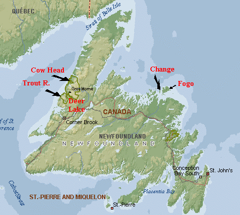
Newfoundland is still there (2006)
The island that became
part of Canada about the time that I was watching Captain Midnight
on a 10-inch B+W TV screen and sending in my cereal boxtops for
the code ring.
You may not find this terribly rewarding
unless you're included here, so this is a good time for casual and
random browsers to turn back before they get too caught up in the
sweep and majesty of the proceedings and can't let go.
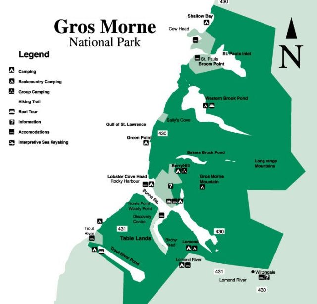
The Gros Morne National
Park: Western Brook Pond (i.e., the "fjord")

That's the glacially-carved fjord-like thing
we're off to see today. The Long Range Mountains run north-south
along the centre of the Gros Morne National Park at more or less
800m altitude, and as we learnt yesterday,
glaciers 15,000 years ago carved out several of these downward
tracks to the sea. When the glaciers melted off, the terrain,
relieved of their weight, duly rose, leaving three kilometres
of peat-boggy flats and little ridges between the fjord and the
coastline.
That's a boggy flat and little ridge right
in front of us now.

The boggiest parts get their own boardwalks
and little bridges over the creeks. Staff get to ride on little
vehicles, we tourists march along behind them.

Coming over the last little ridge, we can see
the Western Brook Pond and the plateaux above. The climb to the
top would be modest, with a good path -- the same elevation-gain
as jogging up from Leysin village to the top of the Tour d'Aï
(the work of 53 minutes in the old days) -- but there aren't many
paths here (and the old days are gone), and it looks like getting
up and back in the same day would take some planning, and some
bushwhacking. There are a few recognized multi-day treks along
the top, however, and we hope that (when we're not carrying a
portable broken-foot cast in our luggage) we will be back for
at least one of them.

Our tour boat, brought in by helicopter some
years ago.

Passengers gather to await the 1 p.m. sailing,
all of whom have walked the trail across the peaty bogs to the
dock, including members of a bicycling rally group who were riding
northward at a leisurely pace from Deer Lake to the Viking attractions
at L'Anse aux Meadows at the far north of the peninsula, over
something like ten days.

Cyclists and civilians await the call to the
boats. These mountains are, by the way, part of the Appalachians
(as are the Great Smokies, which one of us - but not the other
of us - once crossed in the middle of the night to get married
underage in Asheville, N.C.), the very northern end of the range,
in fact.

We're on board our tour boat, and we're so
excited. The Western Brook Pond! ("Pond" is Newfoundlandish
for "really big lake" as well as for "pond".)
38 Canadian dollars apiece is a small price to pay for "billion
year old cliffs" (I thought they said "15,000 years").
(Alas, no senior discounts.) (But Kristin paid anyway.)

Our boat heads out.
Not that boat, that's the other one.
One holds 70 and the other 90, with English-speaking guides on
both of them and the French-speaking guide choosing between them.

Leaving the open lake and heading into the
"fjord". The boat trip takes 2.5 hours and it's worth
the time. It goes out three times a day in July and August, weather
permitting, and booking ahead is a smart move. In June, only one
trip a day, at 1 p.m. (that's us).

Kristin viewing the sights and planning dinner.

From time to time the boats vary the proceedings
by pulling in close to the shore to look up at a particularly
good waterfall or ancient winter caribou path down through one
set of cliffs, across the icy lake, and up the other side; to
point out rock formations on the cliffs to which "old-timers"
have given evocative, folksy names; and to get a closer look when
someone with binoculars shouts out "There's an eagle"!

At one point, the very nice guide pointed to
a rock formation on the cliff that the "old-timers"
referred to "The Tin Man" (from Oz), and when everyone
looked perplexed, he brought round a photocopied photograph of
the cliff with the "Tin Man" face outlined upon it.
I commented at the time that "Thank god, at least it's not
called 'The Old Man of the Mountain'".

That's the end of the lake, 16 kilometres out,
and the starting off point for hikers bound for the heights at
the end of the valley. Our boat is turning round now and going
back. So are we.

Several eagles seen along the shore already,
and everyone is vigilant for still more of them.

As we cruised back out of the fjord, the guide
pointed upwards and said that "for those who might not have
been able to pick out 'The Tin Man' on the rock face, be consoled,
because here we can see 'The Old Man of the Mountain'! See, there's
the nose, the chin", etc.
Well, it wasn't much less evident than Queen
Victoria at Boscastle, Cornwall, and the Sleeping Charles de Gaulle.
(The best Old
Man of the Mountain, the one above Franconia Notch in New
Hampshire, alas! died on 3 May 2003.)

Thrilled tourists make for the bathrooms
and set out for the parking lot on the highway. Kristin's just
anxious to get off for a good supplementary hike in the mud.

Kristin hiking in the mud.

Ah, timely! Now all we need to make the day complete
is a Moose Sighting.

Around the southern end of the lake part of Western
Brook Pond, late in the day.

Down at the shoreline, we can hear in the distance
the dinner gong sounding afar off in Cow Head.
"HURRY UP PLEASE IT'S
TIME" -- Eliot, 1922.

Another Snowshoe Rabbit precedes us as we bolt
for the Shallow Bay lounge and diningroom for a pick-me-up! And
tomorrow, a last day of hikes in the region as we pack up and
promise to come back again.

From National
Parks of Canada

 Feedback
and suggestions are welcome if positive, resented if negative, Feedback
and suggestions are welcome if positive, resented if negative,  .
All rights reserved, all wrongs avenged. Posted 14 August 2006,
revised 8 June 2012, 22 July 2014. .
All rights reserved, all wrongs avenged. Posted 14 August 2006,
revised 8 June 2012, 22 July 2014.
|
